↓
 

Talladega Land Surveying

Your First Choice for Surveying in Talladega County....

Talladega Land Surveying
  • Home
  • ALTA Survey
  • Civil Engineering
  • Drone LiDAR Mapping
  • Elevation Certificate
  • Land Surveying
  • Property Surveying
  • Topographic Survey | Topo Survey
  • Blog
  • Contact Us
Home - Page 3 << 1 2 3

Post navigation

Newer posts →

Not Sure Where Your Property Line Is? Start Here

Talladega Land Surveying Posted on June 11, 2026 by Talladega Land SurveyingJune 9, 2026
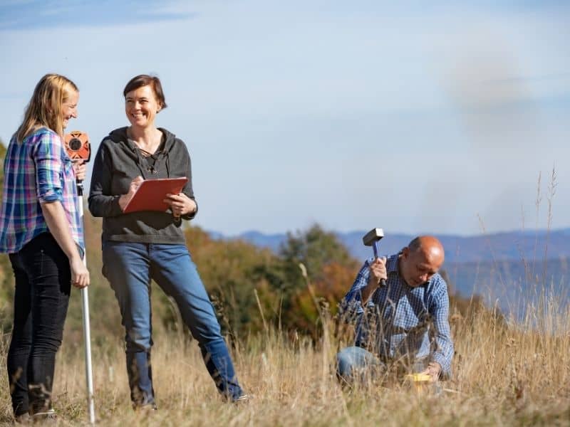
Licensed surveyors locating and setting a boundary marker to help determine property lines

You would be surprised how many property owners have no idea exactly where their property lines fall. Most people have a general sense, but general is not good enough when you are putting up a fence, adding a structure, or dealing with a neighbor who disagrees about where the line is. Here is how to actually find your property lines and what to do when things get complicated.

What Is a Property Line Exactly?

A property line is the legal boundary that separates your land from the land next to it. It is not the edge of your grass, the back of your driveway, or where your neighbor’s fence happens to be sitting. It is a legally defined line that exists in recorded documents and, when properly marked, on the ground itself.

Every parcel of land in Talladega County has boundaries recorded in the deed. Those boundaries were established at some point in history by a surveyor, a government agency, or a legal agreement. The problem is that recorded boundaries and physical markers do not always match up perfectly, especially on older properties.

Ways to Find Your Property Lines

There are a few ways to get a clearer picture of where your lines are, and they range from free to paid depending on how precise you need to be.

Check Your Deed

Your deed is the starting point. It contains a legal description of your property that describes the boundaries using distances, directions, and reference points. This description tells you where the lines are supposed to be, even if it does not tell you exactly where they fall on the ground today.

Deeds for properties in Talladega County are recorded and maintained at the Talladega County Probate Court. If you do not have a copy of your deed, you can request one there or find it through the county’s online records portal.

Reading a deed description is not always straightforward, especially on older properties that use metes and bounds language. But it is always the right place to start.

Look Up the County Plat Maps

If your property is part of a recorded subdivision, there is a plat map on file that shows how the land was divided and where the lot lines fall. Plat maps are also recorded at the Talladega County Probate Court and are often available through the county’s GIS mapping system online.

A plat map gives you a visual layout of your lot and its dimensions. It is a useful reference, but keep in mind that plat maps recorded before 1970 in Talladega County may reflect deed calls that no longer match current ground conditions. They are a starting point, not a final answer.

Look for Physical Markers on the Ground

When a licensed surveyor completes a boundary survey, they set physical monuments at the property corners. In Alabama, these are most commonly iron pins or rebar driven into the ground, sometimes with a plastic cap on top that identifies the surveyor. You might also find concrete posts or wooden stakes depending on how old the survey was.

These markers are often buried just below the surface or hidden in vegetation. A metal detector can help locate iron pins that have been covered over time. If you find markers, do not assume they are accurate without verification. Markers can be moved, disturbed by grading or construction, or simply placed incorrectly on an older survey.

Hire a Licensed Surveyor

If you need a definitive answer, a licensed surveyor is the only way to get one. A surveyor will research the deed records, locate existing monuments, and establish exactly where your property lines fall based on the legal description. That result is something you can actually rely on for construction, fencing, legal proceedings, or a property sale.

This is especially important in Talladega County, where many rural tracts have not been surveyed in decades and older deed descriptions can be ambiguous or conflicting.

Why Property Lines Are Often Harder to Find Than You Think

People assume their property lines are obvious. They are often not, and here is why.

Fences are one of the most common sources of confusion. A fence that has been sitting in the same place for 30 years feels like a boundary. But fences are built by people, and people make mistakes. A fence can be several feet off from the actual legal line and nobody would know unless a survey was done.

Old deed descriptions are another issue. In Talladega County, many older properties were described using metes and bounds language that references trees, rocks, and other natural features that no longer exist. When those reference points disappear, the boundary becomes genuinely difficult to reconstruct without professional research.

Neighboring properties also tell part of the story. What your neighbor’s deed says about the shared line matters just as much as what your deed says. When the two descriptions conflict, things get complicated fast.

What Happens If Your Property Lines Are in Dispute?

If you and a neighbor cannot agree on where the line is, that is a boundary dispute. In Alabama, a disputed property line can result in a legal action called an action to quiet title, which asks a court to officially establish where the boundary falls.

These cases are decided based on deed records, survey evidence, and sometimes the history of how the land has been used over time. Alabama Code Title 35 governs property ownership and boundary law in the state.

The best way to avoid a dispute ever reaching that point is to get a survey done before a conflict starts. Once lawyers get involved, the cost of resolving a boundary problem is almost always higher than the cost of a survey would have been.

Frequently Asked Questions

Can I find my property lines for free?

You can get a general idea using your deed and county plat maps, both of which are accessible through the Talladega County Probate Court records. These give you a starting point, but they will not tell you exactly where the lines fall on the ground today. For that, you need a licensed surveyor.

Are property lines on Google Maps accurate?

No. Property line overlays on Google Maps and similar tools are pulled from parcel data and are not precise. They can be off by several feet in either direction. Never use them to make decisions about fencing, construction, or boundary disputes.

What do property line markers look like?

In Alabama, the most common markers are iron pins or rebar set in the ground at property corners, sometimes with a colored plastic cap identifying the surveying firm. Older properties may have concrete posts or other monuments. They are often flush with the ground or just below the surface.

Can a neighbor dispute where my property line is?

Yes, and it happens more often than people expect. If a neighbor believes the line is in a different location than you do, the disagreement needs to be resolved either through a new survey that both parties accept or through legal action. Having a current survey on file is the strongest position to be in if a dispute comes up.

Do I need a surveyor to find my property line?

If you are making any kind of decision that depends on knowing exactly where the line is, then yes. Deed research and plat maps can get you close, but only a licensed surveyor can give you a legally defensible answer. That matters for fences, construction, sales, and any situation where the location of the line could be challenged.

Posted in boundary surveying | Tagged property survey

The Real Cost of a Land Survey Nobody Tells You About

Talladega Land Surveying Posted on June 10, 2026 by Talladega Land SurveyingJune 11, 2026
Professional explaining survey documents to a property owner while discussing land survey cost and planning considerations.

If you have ever called a surveyor for a quote and hung up more confused than before, you are not alone. Land survey cost is one of those topics where the answer is almost always “it depends,” and that can be frustrating when you are trying to plan a project or budget for a home purchase. This guide breaks down what you are actually paying for, what drives the price up, and what a fair quote looks like in Talladega, Alabama.

What Does a Land Survey Cost?

For most homeowners, a standard boundary survey runs somewhere between $400 and $1,500. If you need something more involved, like an ALTA survey for a commercial property, expect to pay quite a bit more. Some of those can run $5,000 or higher depending on the scope.

There is no single flat fee for a land survey. The price depends on the type of survey, the size of the property, and a few other factors covered below. Here is a general range of what you can expect to pay:

Survey TypeTypical Cost RangeCommon Use
Boundary Survey$400 to $1,200Property lines, fences, disputes
Topographic Survey$800 to $2,500Construction, grading, drainage
ALTA Survey$1,500 to $5,000+Commercial real estate, lenders
Elevation Certificate$300 to $700Flood insurance, FEMA requirements
Subdivision Survey$1,000 to $4,000+Dividing land into multiple lots

Most residential land surveys fall somewhere between $400 and $800 for a straightforward lot. That number moves up quickly once terrain, lot size, or deed complexity enters the picture.

What Factors Drive the Cost of a Land Survey Up?

A lot of things play into the final number. The size of the lot, how dense the vegetation is, how far back the deed history goes, and whether the old survey markers are still in the ground. Change any one of those and the price changes with it.

Surveyors do not pull a number out of thin air. The quote you get is based on how much time and effort your specific property will take. Here are the main things that affect the final price.

Property Size and Shape

Larger properties take longer to survey. Oddly shaped lots with many corners also take more time than a simple rectangle. A small in-town lot in Talladega will almost always cost less to survey than a 10-acre rural tract out in Talladega County.

Terrain and Vegetation

Flat, open land is easy to work on. Steep hillsides, dense woods, and overgrown lots slow everything down. Heavily wooded or hilly terrain can increase survey costs by 20 to 40 percent compared to flat, open lots of the same size. Talladega County has plenty of both, so this factor matters more here than it might in other parts of Alabama.

Deed Research and Records

Before a surveyor ever sets foot on your property, they are usually at the courthouse pulling deeds and old records. The further back the history goes, the longer this takes. Properties that have never been surveyed, or were last surveyed before 1980, typically require more deed research. That extra time gets added to your bill.

Whether Old Monuments Can Still Be Found

Survey monuments are the physical markers left behind by previous surveys. Iron pipes, rebar, concrete posts. If those markers are still in the ground and match the deed, the surveyor’s fieldwork goes faster. If they are missing or have been disturbed, the surveyor has to do more work to re-establish the corners, and that takes time.

How to Get an Accurate Quote From a Surveyor

Most surveyors will not give you a firm price over the phone without some basic information. The more you can provide upfront, the more accurate your estimate will be.

What to Have Ready Before You Call

  • The legal description of your property, found on the deed
  • The approximate size of the lot in acres or square feet
  • The address and county where the property is located
  • What you plan to use the survey for, such as a fence, sale, or new construction
  • Whether any previous surveys have been done on the property

Questions to Ask Your Surveyor

  • What is included in this quote and what could cause the price to change?
  • How long will the survey take from start to finish?
  • Will you provide a plat or survey drawing I can keep?
  • Are you licensed as a Professional Land Surveyor?

Alabama requires a licensed Professional Land Surveyor (PLS) for all legal boundary surveys under Alabama Code Title 34, Chapter 11. Always verify your surveyor holds an active Alabama PLS license before work begins.

Is a Land Survey Worth the Cost?

Almost always, yes. A survey costs a fraction of what you would spend fixing a fence built on the wrong line, dealing with an encroachment dispute, or pulling a permit that gets rejected because the setbacks are off. Doing it before you build is always cheaper than doing it after something goes wrong.

In Talladega County, where rural tracts often have old or unclear boundary records, knowing exactly where your lines are before you commit to anything is not just helpful. It is real protection. The cost of a land survey is almost always small compared to what is at stake.

Posted in land surveying | Tagged land surveying

What is a Land Surveyor?

Talladega Land Surveying Posted on May 4, 2026 by Talladega Land SurveyingMay 4, 2026
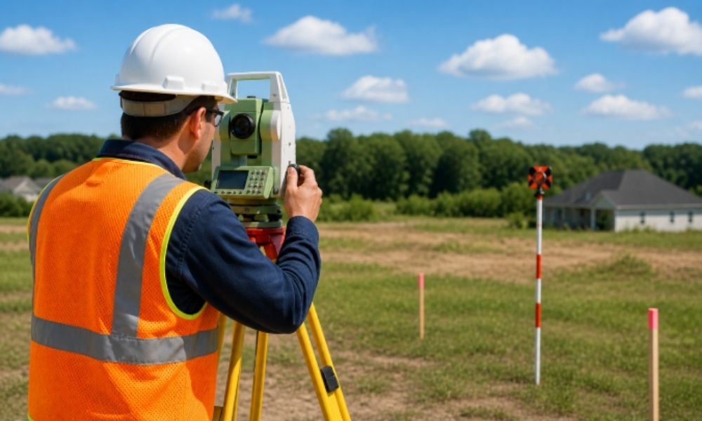
Land surveyor using equipment to measure property boundary in an open field

A land surveyor measures land and identifies exact property boundaries. They confirm where a property begins and ends and check features that affect land use. Their work supports buying, building, and legal decisions by providing accurate and verified property information through land surveying. 

Most people think a surveyor only places markers. That is only part of the job.A surveyor helps you avoid problems before you buy, build, or sell a property. 

Do You Need a Land Surveyor?

Yes, in many cases. A land surveyor confirms boundaries, checks for issues, and provides accurate data about your property. This helps prevent mistakes before building, buying land, or resolving disputes. Without a survey, decisions rely on guesswork, which often lead to costly problems.

Skipping this step creates risk. Many issues show up only after work begins.

What Does a Land Surveyor Do?

A land surveyor measures land, verifies property lines, and identifies features that affect land use. They check boundaries, locate easements, map elevation, and find encroachments. This information helps property owners plan projects, secure permits, and avoid costly mistakes before construction or purchase.

They compare legal records with real conditions on the ground. That is where the value comes from. They do not just measure. They verify. 

Property Boundaries

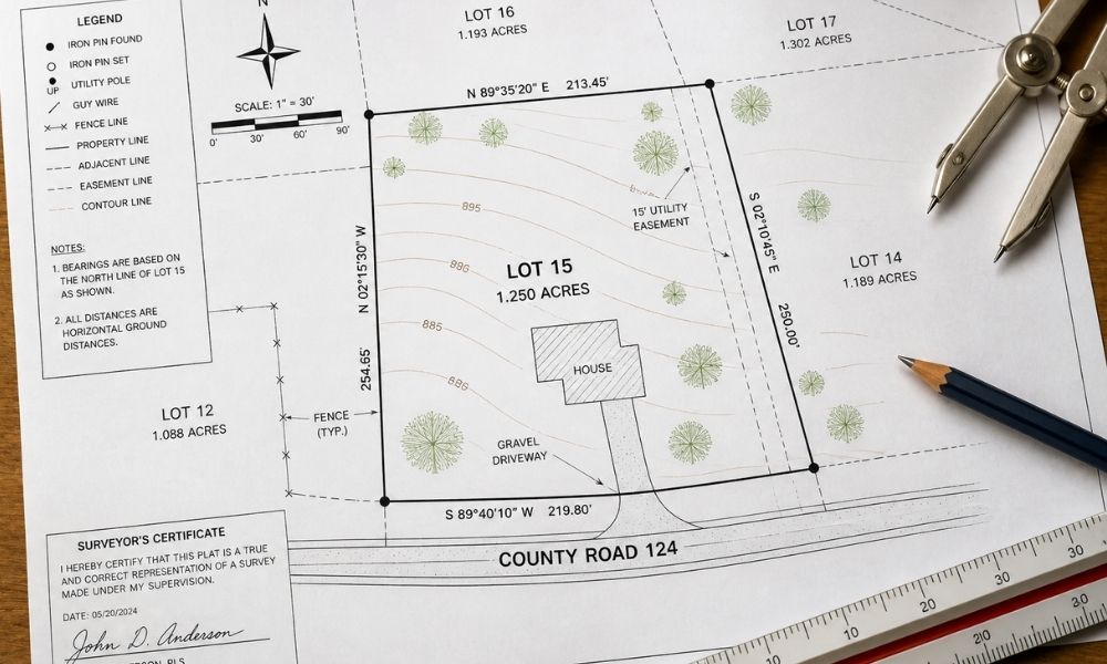
Surveyors locate exact boundary lines and corner points using deeds, maps, and field measurements.

Old fences or markers do not always match legal lines. Many people trust them anyway. That leads to disputes.

Land Measurements

Surveyors measure distances, angles, and elevation.They use GPS tools and other equipment to collect accurate data. 

These measurements show the true shape and size of a property. Plans depend on this information. 

Land surveyor property boundary map showing lot lines easements measurements and site details

Easements and Access

Some parts of a property have limits on use.

A surveyor identifies:

  • Utility easements
  • Shared driveways
  • Access paths

You may own the land but still have limits on how you can use it. 

Topography and Slope

Land is rarely flat. A surveyor maps slopes, elevation changes, and low areas.

This helps with:

  • Drainage planning
  • Foundation design
  • Road placement

Ignoring land shape often leads to water problems.

Encroachments

An encroachment happens when something crosses a property line.

Examples include:

  • A fence built over the line
  • A shed placed in the wrong spot
  • A driveway crossing into another lot

A surveyor finds these early, before they turn into legal issues.

Why is a Land Surveyor Important?

A land surveyor provides accurate property data that helps prevent construction errors, avoids disputes, and supports permit approvals. Without a survey, property decisions rely on guesswork. This often leads to delays, added costs, and legal problems.

Avoid Costly Errors

Boundary mistakes can delay projects by one to three weeks or more. In some cases, work must be removed or rebuilt.

Fixing a mistake costs more than preventing it.

Prevent Disputes

Many property disputes come from unclear or outdated boundary data. A survey provides clear proof.

This reduces conflict and saves time.

Support Permits

Many projects require survey data. Local offices may ask for:

  • Property lines
  • Setbacks
  • Elevation details

Without this, your permit can be delayed or denied.

Protect Property Value

Clear boundaries and accurate records help protect your property. Buyers feel more confident when everything is documented. 

What Happens If You Do Not Hire a Land Surveyor?

Skipping a land survey creates real problems. Most show up after work starts, when fixes cost more.

You might:

  • Build a fence 2 to 4 feet past your boundary and have to remove it
  • Pour a driveway that crosses into a neighbor’s lot and cut it back
  • Place a house too close to a setback line and fail inspection
  • Block a utility easement and clear it later for access
  • Pause your project for 1 to 3 weeks while fixing layout issues

These cases happen often.

Many owners rely on online maps or old sketches. Those can be off by several feet. That gap is enough to place something in the wrong spot.

Once work starts, changes cost more. Labor, materials, and time all increase.

A survey done early avoids these issues.

How a Land Surveyor Works on Your Property 

A land survey begins with research of property records and legal descriptions. The surveyor then visits the site, takes measurements, and places markers. After collecting data, they create a survey drawing that shows boundaries, structures, and key features for planning and legal use.

The process usually follows these steps:

  • Review deeds and past surveys
  • Visit the site and measure the land
  • Mark boundary points
  • Record field data
  • Prepare a survey drawing

This drawing guides planning, permits, and construction.

Choosing the Right Land Surveyor

Not all surveyors handle the same type of work. Some focus on residential lots, while others handle larger properties.

Look for:

  • A licensed professional
  • Experience with your type of property
  • Clear communication

If you are planning a project, working with a land surveyor in Talladega, Alabama or your local area can help you understand local rules and site conditions.

FAQ About Land Surveyors

What is a land surveyor?

A land surveyor measures land and confirms property boundaries. They provide accurate data used for building, buying, and resolving disputes.

What does a land surveyor do?

They measure land, verify boundaries, identify easements, and map land features that affect use and construction.

When do you need a land survey?

Before buying land, building, installing fences, or resolving boundary issues.

How much does a land survey cost?

Costs vary based on property size, location, and complexity. Smaller residential surveys cost less than large or detailed surveys.

How long does a land survey take?

Most surveys take a few days. Larger or complex properties may take longer.

Posted in land surveying | Tagged land surveying, land surveyor, property boundaries, property survey, surveyor services

Post navigation

Newer posts →
Get Quote Button
© Boxer Survey USA
TalladegaLandSurveying.com
Talladega, Alabama
Phone: (256) 854-9503

Web Development and SEO by:
AuburnBusiness.com, LLC


Privacy Policy | Terms of Use

The owner of this website, Boxer Survey USA, provides coordination of professional land surveying and engineering services in all 50 states. The professional surveying and engineering services provided to you will be conducted by fully licensed professionals in your state.

&nbsp Privacy Policy
↑