

↓
 

Talladega Land Surveying

Your First Choice for Surveying in Talladega County....

Talladega Land Surveying
  • Home
  • ALTA Survey
  • Civil Engineering
  • Drone LiDAR Mapping
  • Elevation Certificate
  • Land Surveying
  • Property Surveying
  • Topographic Survey | Topo Survey
  • Blog
  • Contact Us
Home - Page 2 << 1 2 3 >>

Post navigation

← Older posts
Newer posts →

What to Ask a Surveyor Before You Ever Sign Anything

Talladega Land Surveying Posted on June 18, 2026 by Talladega Land SurveyingJune 10, 2026
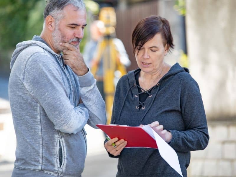
Property owner meeting with a land surveyor to discuss survey details before signing a contract.

Hiring a surveyor is not something most people do often. When the need comes up, it usually comes with a deadline. A closing date, a permit application, a neighbor dispute that needs to be settled. The pressure to just pick someone and move forward is real. But asking the right questions before you sign a contract can save you a lot of headaches later. Here is what to ask and why each question matters.

Ask About Their Experience With Your Type of Property

Not all surveying work is the same. A surveyor who mostly handles small residential lots in town may not have much experience with large rural tracts. A firm that focuses on commercial work may not be the best fit for a straightforward residential boundary job.

In Talladega County, property types vary a lot. You have small in-town lots, large rural tracts with old deed histories, properties along creek and river corridors, and everything in between. Ask the surveyor directly whether they have handled properties similar to yours.

Good questions to ask:

  • Have you worked on properties in this part of Talladega County before?
  • How much of your work involves rural tracts versus residential lots?
  • Have you dealt with properties that have old or unclear deed descriptions?

A surveyor who has worked in your area knows the local courthouse records, understands the quirks of how properties in that part of the county were historically divided, and is less likely to run into surprises that slow things down.

Ask Exactly What Is Included in the Quote

This is where a lot of misunderstandings happen. Two surveyors can give you very different quotes for what sounds like the same job, and the difference often comes down to what each one is actually including.

Some quotes cover the full process from deed research through to the final signed plat. Others are priced for a limited scope of work that may not include everything you actually need. Ask the surveyor to walk you through exactly what the quote covers.

Specific things to clarify:

  • Does the quote include deed research and courthouse records review?
  • Will I receive a signed and sealed survey plat when the job is done?
  • Are monument placement and corner marking included?
  • Is there anything that could cause the price to change after work begins?
  • If additional research is needed, how will that be communicated and billed?

Getting clear answers to these questions upfront means no surprises on the final invoice.

Ask About the Contract and What It Says

A reputable surveyor will put the scope of work in writing before anything starts. Read the contract carefully before signing. It should spell out exactly what work will be done, what the deliverables are, the estimated timeline, and the total fee or billing structure.

Pay attention to these things in the contract:

  • Is the scope of work clearly described, not just a general statement?
  • Are the deliverables listed, specifically whether a signed plat is included?
  • Is there a clause about what happens if the price changes?
  • What are the payment terms?

If a surveyor is reluctant to put the details in writing, that is a reason to pause. A written contract protects both parties and keeps everyone on the same page about what was agreed to.

Ask How They Handle Unexpected Problems

Surveying does not always go smoothly. Sometimes the deed research turns up conflicting descriptions. Sometimes monuments that should be there are not. Sometimes a neighboring property has a recorded document that complicates the picture.

How a surveyor handles these situations matters. Ask them directly.

  • What happens if you find conflicting deed descriptions during research?
  • How do you handle a situation where existing monuments do not match the deed?
  • Will you contact me before doing additional work that was not in the original scope?

A good surveyor will have straightforward answers to these questions. They deal with complications regularly and should be able to explain their process clearly. If the answers are vague, that is worth noting.

Ask About Communication During the Job

Once the contract is signed, a lot of property owners feel like they are left in the dark until the finished plat arrives. That does not have to be the case.

Ask the surveyor how they prefer to communicate and what you can expect in terms of updates.

  • Who is the main point of contact for questions once work begins?
  • Will you let me know when fieldwork is scheduled?
  • How will you reach me if something comes up that I need to know about?
  • What is the best way to get in touch if I have questions?

Knowing who to call and what to expect keeps the process from feeling like a mystery. It also means you are not left wondering whether anything is actually happening on your job.

Ask About the Timeline and What Could Affect It

Timelines in surveying depend on a lot of factors. Courthouse research takes time. Field schedules fill up. Weather affects fieldwork. If you have a deadline, the surveyor needs to know about it upfront, and you need an honest answer about whether it is achievable.

Ask these questions before the contract is signed:

  • What is your estimated timeline from start to finish?
  • What could slow this job down?
  • Do you have current availability, or is there a backlog?
  • If I have a closing date or permit deadline, can you meet it?

A surveyor who gives you a realistic timeline with honest caveats is more valuable than one who tells you what you want to hear. If the timeline does not work for your situation, it is better to know that before the contract is signed than after.

Frequently Asked Questions

Do I need a written contract for a land survey?

Yes. Always get the scope of work, deliverables, timeline, and fees in writing before any work begins. A verbal agreement is difficult to enforce if a disagreement comes up later. A written contract protects you and sets clear expectations for both sides.

Can I negotiate the price with a surveyor?

In some cases, yes. If the scope of work is flexible, you may be able to adjust what is included to bring the cost down. However, cutting corners on things like deed research or monument placement usually creates problems later. It is worth understanding what you are giving up before agreeing to a reduced scope.

What if I am not satisfied with the survey results?

Start by talking directly with the surveyor. Most issues come from miscommunication about scope or expectations, and a good surveyor will work with you to address concerns. If the issue is a genuine error in the work, the surveyor’s professional liability applies. If the disagreement cannot be resolved, you can file a complaint with the Alabama Board of Licensure for Professional Engineers and Land Surveyors.

Should I be present during the fieldwork?

You do not have to be, but it can be helpful to be available by phone in case the crew has questions about access or encounters something unexpected on the property. Some property owners like to walk the site with the surveyor after fieldwork is done to see where the corners were set.

How do I know if the finished survey is correct?

Review the final plat carefully when you receive it. The dimensions and boundary descriptions on the plat should match your deed. If anything looks off or does not match what you expected, ask the surveyor to walk you through it before you sign off. A licensed surveyor should be able to explain every line and measurement on the drawing.
Posted in land surveyor | Tagged land surveyor

Why Hiring a Licensed Land Surveyor Is Not Optional

Talladega Land Surveying Posted on June 17, 2026 by Talladega Land SurveyingJune 11, 2026
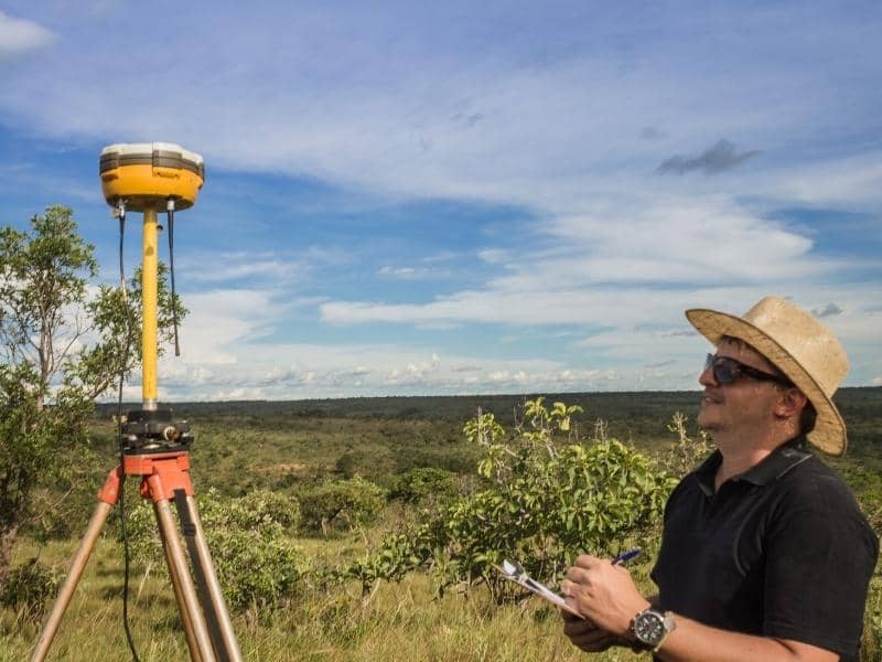
Licensed land surveyor using GPS equipment to collect measurements during field work

When people start looking for a surveyor, the urge to go with whoever is cheapest is understandable. Maybe someone offers a lower quote, or a neighbor knows a guy who does surveys on the side. Before you go that route, it is worth knowing what a licensed land surveyor actually is, what that license means in Alabama, and why it matters more than most people think.

What Makes Someone a Licensed Land Surveyor?

A licensed land surveyor is not just someone who owns surveying equipment. The license means they have spent years studying, working in the field, and passing difficult exams before the state ever allowed them to work independently.

In Alabama, getting a Professional Land Surveyor license is a serious process. Here is what it takes.

Education

Candidates need a degree in surveying, geomatics, or a related field. Some qualify through a combination of education and years of hands-on experience, but a formal degree is the most common path.

Field Experience

Before taking the licensing exam, candidates must spend years working under a licensed surveyor. This is where they learn the real-world skills that a classroom cannot fully teach. Things like reading old deed language, figuring out conflicting property descriptions, and solving boundary problems out in the field.

Two Separate Exams

There are two exams required to get licensed. The first is the Fundamentals of Surveying exam, which tests core technical knowledge. The second is the Principles and Practice of Surveying exam, which tests how well someone can apply that knowledge to real problems. Both are administered by the National Council of Examiners for Engineering and Surveying. You have to pass both before a license is issued.

Ongoing Education

Getting licensed is not the end of it. Alabama requires licensed surveyors to keep learning through continuing education to maintain their license. This keeps them current with changes in technology, standards, and state law.

Why the License Actually Matters for Your Property

The license is not just a formality. It has real legal weight that affects you as a property owner.

Only a Licensed Surveyor Can Produce a Legal Survey 

Alabama law requires that any boundary survey used for legal purposes, such as a property sale, a building permit, or a recorded document, must be signed and sealed by a licensed Professional Land Surveyor. A survey done by someone without that license is not a legal document. A title company will not accept it. It will not hold up if a boundary is ever challenged.

The License Creates Accountability

When a licensed surveyor signs and seals your survey, they are putting their license and professional reputation on the line. If their work is careless or wrong, they can face disciplinary action from the Alabama Board of Licensure, be held liable in civil court, and even lose their license.

None of that accountability exists with an unlicensed person. If something goes wrong with an unlicensed survey, you are left dealing with the mess on your own.

Licensed Surveyors Carry Insurance

Most licensed surveyors carry errors and omissions insurance. This protects you if a mistake in the survey causes financial harm. For example, if a boundary is set incorrectly and you end up building a structure on your neighbor’s land, that insurance matters. An unlicensed person working informally almost certainly does not have it.

How to Check a Surveyor’s License in Alabama

Do not just take someone’s word for it. The Alabama Board of Licensure for Professional Engineers and Land Surveyors has a public license lookup tool on their website. You can search by name or license number and confirm the license is active before any work starts.

When you contact a surveying firm, it is completely fine to ask for the PLS license number of the surveyor handling your job. Any legitimate professional will give it to you without hesitation.

The Difference Between a Licensed Surveyor and a Survey Technician

This is something that confuses a lot of people. Many surveying firms send field technicians out to collect measurements and set up equipment. These technicians can be skilled and experienced, but they are not licensed surveyors.

The licensed Professional Land Surveyor is the person who is legally responsible for the entire survey. They review the deed research, direct the fieldwork, make the professional decisions about where the boundaries fall, and sign the final product. The technicians support that process, but they cannot replace the licensed surveyor.

When you hire a surveying firm, you are really hiring the judgment and legal accountability of the licensed surveyor behind the work.

Red Flags to Watch for When Hiring a Surveyor

Most surveyors are professionals who do good work. But here are a few things worth watching out for.

  • Someone who cannot give you a PLS license number when asked
  • A quote that is much lower than others with no explanation of what is left out
  • A surveyor who skips deed research and goes straight to fieldwork
  • Anyone offering to do the work informally without a written contract
  • A firm that cannot tell you who the licensed surveyor of record will be on your job

If any of these come up, keep looking.

Frequently Asked Questions

What does PLS stand for in surveying?

PLS stands for Professional Land Surveyor. It is the official title for someone who has met Alabama’s education, experience, and exam requirements to practice land surveying. Only a PLS can sign and seal a legal survey in Alabama.

Is there a difference between a licensed surveyor and a registered surveyor?

Not really. Some states use the word registered, others use licensed. In Alabama, the official title is Professional Land Surveyor. Both terms refer to the same type of credential, just worded differently depending on the state.

Can an engineer do a land survey?

Not automatically. A Professional Engineer license and a Professional Land Surveyor license are two separate credentials. An engineer cannot perform legal boundary surveys unless they also hold a PLS license. Some people hold both, but the licenses are separate.

What happens if a licensed surveyor makes a mistake on my property?

If a licensed surveyor makes an error that causes you financial harm, you may have grounds for a professional liability claim. They are accountable to the Alabama Board of Licensure, and serious errors can lead to disciplinary action against their license. This protection does not exist when you work with someone who is not licensed.

How do I find a licensed land surveyor in Talladega, Alabama?

The Alabama Board of Licensure for Professional Engineers and Land Surveyors has a public license search on their website where you can look up active PLS holders. Local title companies and real estate attorneys in Talladega are also good sources of referrals since they work with surveyors regularly.

Posted in land surveyor | Tagged land surveyor

Everything You Need to Know About a Property Boundary Survey

Talladega Land Surveying Posted on June 12, 2026 by Talladega Land SurveyingJune 10, 2026
Homeowners reviewing documents during a property boundary survey with a licensed surveyor

If someone has told you that you need a property boundary survey and you are not entirely sure what that means, you are in good company. Most people only encounter this type of survey once or twice in their lives, usually right before something important happens with their property. Here is a plain, straightforward look at what a property boundary survey actually is, what it covers, and what you can expect from the process in Talladega, Alabama.

What Is a Property Boundary Survey?

A property boundary survey is a formal process where a licensed surveyor determines the exact legal boundaries of a parcel of land. The surveyor researches the deed records, examines the history of the property, locates or sets physical monuments at the corners, and produces a drawing that shows where the boundaries fall.

The end result is a legal document. It is not just a sketch or a general estimate. A properly completed boundary survey can be recorded, used in court, relied on for construction permits, and referenced in a property sale. That is what makes it different from simply looking up your parcel on a county map.

What Does a Property Boundary Survey Actually Cover?

A boundary survey covers more than most people expect. Here is what a licensed surveyor typically does during the process.

Deed and Title Research

The surveyor starts at the courthouse, not on your property. They pull your deed, review the legal description, and examine the deeds of neighboring properties to understand how the surrounding land has been divided over time. This research is what gives the survey its legal foundation.

In Talladega County, this research often involves going back through decades of recorded documents, especially on rural tracts that have been divided and transferred multiple times.

Field Work

Once the research is done, the crew heads out to the property. They use instruments like a total station or GPS equipment to measure distances and angles, locate any existing monuments, and establish the boundary corners based on what the deed records show.

If existing monuments are found and verified, the surveyor confirms their location. If corners cannot be found or need to be re-established, the surveyor sets new monuments at the correct positions.

The Survey Drawing

After the fieldwork is complete, the surveyor produces a plat or drawing that shows the property boundaries, the dimensions of each line, the location of monuments, and any relevant features like easements or encroachments that were observed during the survey.

This drawing is the deliverable you keep. It shows exactly what the survey found and serves as the official record of your property boundaries.

When Do You Actually Need a Property Boundary Survey?

Not every situation calls for one, but there are certain times when getting a boundary survey done is the right move.

Before building anything close to a property line. Setback requirements in Talladega and Talladega County specify how close a structure can be to the boundary. If you are building a garage, shed, addition, or any permanent structure near the edge of your lot, a boundary survey tells you exactly where you stand before you start.

Before a property sale or purchase. Buyers and sellers both benefit from knowing the exact boundaries of what is changing hands. Lenders sometimes require a survey as part of the closing process, and title companies may flag boundary issues that need to be resolved before closing.

When an encroachment is suspected. An encroachment happens when something, a structure, a driveway, a fence, crosses over onto land it does not belong to. If you suspect something on your property or a neighboring property is not where it should be, a boundary survey settles the question with documented evidence.

When you are dividing land. If you plan to split a parcel into two or more lots, a boundary survey is the starting point. The surveyor establishes the existing boundaries before any new division lines can be legally created.

What a Property Boundary Survey Does Not Cover

This is something people get wrong fairly often. A boundary survey is focused specifically on the legal boundaries of the property. It does not include elevation data, detailed topography, or the kind of information a lender needs for a commercial transaction. Those require different survey types.

A boundary survey also does not resolve a dispute on its own. If a neighbor disagrees with the results, the survey is evidence, but it is not automatically the final word. Disputes that cannot be resolved between the parties may still end up needing legal resolution.

How Long Does a Property Boundary Survey Take?

The timeline depends on the complexity of the property and how backed up the surveying firm is. For a straightforward residential lot, the full process from deed research to final drawing typically takes one to three weeks.

Rural properties, large tracts, or parcels with complicated deed histories can take longer. If the surveyor uncovers conflicting descriptions or missing monuments, that adds time to the research and fieldwork phases.

It is worth asking about the timeline upfront when you call for a quote, especially if you are working against a closing date or a permit deadline.

What You Receive When the Survey Is Done

When the survey is complete, you should receive a signed and sealed survey plat from the licensed surveyor. In Alabama, a survey must be signed and sealed by a Professional Land Surveyor to be considered a legal document.

Hold on to this document. Store a physical copy somewhere safe and keep a digital copy as a backup. If you ever sell the property, deal with a permit, or face a boundary question in the future, that survey plat is one of the most useful documents you can have on hand.

Posted in boundary surveying | Tagged property boundaries, property survey

Post navigation

← Older posts
Newer posts →
Get Quote Button
© Boxer Survey USA
TalladegaLandSurveying.com
Talladega, Alabama
Phone: (256) 854-9503

Web Development and SEO by:
AuburnBusiness.com, LLC


Privacy Policy | Terms of Use

The owner of this website, Boxer Survey USA, provides coordination of professional land surveying and engineering services in all 50 states. The professional surveying and engineering services provided to you will be conducted by fully licensed professionals in your state.

&nbsp Privacy Policy
↑